Showing 1 - 15 of 674 results
Airborne Hyperspectral Reflectance L1 Tallgrass Prairie Preserve Oklahoma Multi-Day 1 m
Airborne Hyperspectral Reflectance LTER Cedar Creek Minnesota Daily 300 mm
Airborne Hyperspectral Reflectance Indian Cave Nebraska Multi-Day 1 m
Airborne Hyperspectral Reflectance Wood River Nebraska Multi-Day 1 m
ASTER Global Emissivity Dataset 100 meter HDF5
ASTER Global Emissivity Dataset 100 meter Binary
ASTER Global Emissivity Dataset 1 kilometer HDF5
ASTER Global Emissivity Dataset 1 kilometer Binary
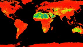
ASTER Global Emissivity Dataset, Monthly, 0.05 Degree, HDF5
ASTER Global Emissivity Dataset, Monthly, 0.05 degree, HDF5
ASTER Global Emissivity Dataset, Monthly, 0.05 degree, NetCDF4


ASTER Digital Elevation Model and Orthorectified Registered Radiance at the Sensor