Showing 241 - 300 of 481 results
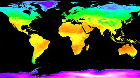
MODIS/Terra Land Surface Temperature/3-Band Emissivity Daily L3 Global 0.05 Deg CMG
MODIS/Terra Land Surface Temperature/3-Band Emissivity 8-Day L3 Global 0.05 Deg CMG
MODIS/Terra Land Surface Temperature/3-Band Emissivity Monthly L3 Global 0.05 Deg CMG

MODIS/Terra Vegetation Continuous Fields Yearly L3 Global 250 m SIN Grid
MODIS/Terra Land Water Mask Derived from MODIS and SRTM L3 Yearly Global 250 m SIN Grid
MODIS/Terra Land Water Mask Derived from MODIS and SRTM L3 Yearly Global 250 m SIN Grid
MuSLI Multi-Source Land Surface Phenology Yearly North America 30 m
MODIS/Aqua Surface Reflectance 8-Day L3 Global 500 m SIN Grid
MODIS/Aqua Surface Reflectance Daily L3 Global 0.05 Deg CMG
MODIS/Aqua Surface Reflectance Daily L2G Global 1 km and 500 m SIN Grid
MODIS/Aqua Surface Reflectance Daily L2G Global 250 m SIN Grid
MODIS/Aqua Surface Reflectance 8-Day L3 Global 250 m SIN Grid
MODIS/Aqua Land Surface Temperature/Emissivity Daily L3 Global 1 km SIN Grid
MODIS/Aqua Land Surface Temperature/Emissivity 8-Day L3 Global 1 km SIN Grid
MODIS/Aqua Land Surface Temperature/Emissivity Daily L3 Global 6 km SIN Grid
MODIS/Aqua Land Surface Temperature/Emissivity 8-Day L3 Global 6 km SIN Grid
MODIS/Aqua Land Surface Temperature/Emissivity Monthly L3 Global 6 km SIN Grid
MODIS/Aqua Land Surface Temperature/Emissivity Daily L3 Global 0.05 Deg CMG
MODIS/Aqua Land Surface Temperature/Emissivity 8-Day L3 Global 0.05 Deg CMG
MODIS/Aqua Land Surface Temperature/Emissivity Monthly L3 Global 0.05 Deg CMG
MODIS/Aqua Land Surface Temperature/Emissivity 5-Minute L2 Swath 1 km

MODIS/Aqua Vegetation Indices 16-Day L3 Global 500 m SIN Grid
MODIS/Aqua Vegetation Indices 16-Day L3 Global 1 km SIN Grid
MODIS/Aqua Vegetation Indices Monthly L3 Global 1 km SIN Grid

MODIS/Aqua Vegetation Indices 16-Day L3 Global 0.05 Deg CMG
MODIS/Aqua Vegetation Indices Monthly L3 Global 0.05 Deg CMG
MODIS/Aqua Vegetation Indices 16-Day L3 Global 250 m SIN Grid
MODIS/Aqua Thermal Anomalies/Fire 5-Minute L2 Swath 1 km
MODIS/Aqua Thermal Anomalies/Fire Daily L3 Global 1 km SIN Grid
MODIS/Aqua Thermal Anomalies/Fire 8-Day L3 Global 1 km SIN Grid
MODIS/Aqua Leaf Area Index/FPAR 8-Day L4 Global 500 m SIN Grid
MODIS/Aqua Net Evapotranspiration 8-Day L4 Global 500 m SIN Grid
MODIS/Aqua Net Evapotranspiration Gap-Filled 8-Day L4 Global 500 m SIN Grid
MODIS/Aqua Net Evapotranspiration Gap-Filled Yearly L4 Global 500 m SIN Grid
MODIS/Aqua Gross Primary Productivity 8-Day L4 Global 500 m SIN Grid
MODIS/Aqua Gross Primary Productivity Gap-Filled 8-Day L4 Global 500 m SIN Grid
MODIS/Aqua Net Primary Production Gap-Filled Yearly L4 Global 500 m SIN Grid
MODIS/Aqua Land Surface Temperature/3-Band Emissivity 5-Min L2 1 km
MODIS/Aqua Land Surface Temperature/3-Band Emissivity Daily L3 Global 1 km SIN Grid Day
MODIS/Aqua Land Surface Temperature/3-Band Emissivity Daily L3 Global 1 km SIN Grid Night
MODIS/Aqua Land Surface Temperature/3-Band Emissivity 8-Day L3 Global 1 km SIN Grid
MODIS/Aqua Land Surface Temperature/3-Band Emissivity Daily L3 Global 0.05 Deg CMG
MODIS/Aqua Land Surface Temperature/3-Band Emissivity 8-Day L3 Global 0.05 Deg CMG
MODIS/Aqua Land Surface Temperature/3-Band Emissivity Monthly L3 Global 0.05 Deg CMG


OPERA Land Surface Disturbance Alert from Harmonized Landsat Sentinel-2 provisional product (Version 0)
OPERA Land Surface Disturbance Alert from Harmonized Landsat Sentinel-2 product (Version 1)
OPERA Land Surface Disturbance Annual from Harmonized Landsat Sentinel-2 product (Version 1)
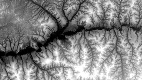
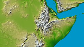
NASA Shuttle Radar Topography Mission Global 1 arc second number