Showing 1 - 90 of 480 results
Airborne Hyperspectral Reflectance L1 Tallgrass Prairie Preserve Oklahoma Multi-Day 1 m
Airborne Hyperspectral Reflectance LTER Cedar Creek Minnesota Daily 300 mm
Airborne Hyperspectral Reflectance Indian Cave Nebraska Multi-Day 1 m
Airborne Hyperspectral Reflectance Wood River Nebraska Multi-Day 1 m
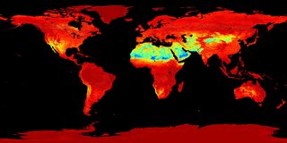
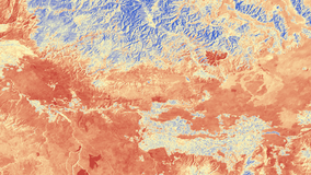
ASTER Global Emissivity Dataset 100 meter HDF5
ASTER Global Emissivity Dataset 1 kilometer HDF5
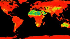
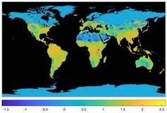
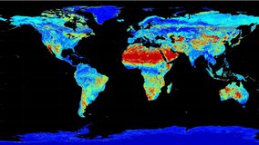
ASTER Global Emissivity Dataset, Monthly, 0.05 Degree, HDF5


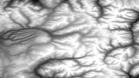
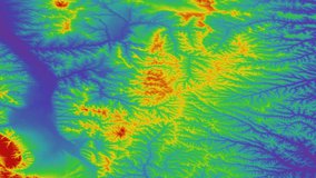
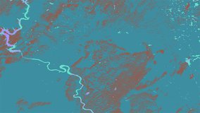
ASTER Digital Elevation Model and Orthorectified Registered Radiance at the Sensor

ASTER L2 Surface Reflectance VNIR and Crosstalk Corrected SWIR

ASTER L2 Surface Radiance VNIR and Crosstalk Corrected SWIR


ASTER Level 1 Precision Terrain Corrected Registered At-Sensor Radiance
ASTER Level 1 Precision Terrain Corrected Registered At-Sensor Radiance
Combined ASTER and MODIS Emissivity database over Land (CAMEL) Coefficient Monthly Global 0.05Deg
Combined ASTER and MODIS Emissivity database over Land (CAMEL) Coefficient Monthly Global 0.05Deg
Combined ASTER and MODIS Emissivity database over Land (CAMEL) Emissivity Monthly Global 0.05Deg
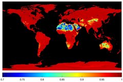
Combined ASTER and MODIS Emissivity database over Land (CAMEL) Emissivity Monthly Global 0.05Deg
Combined ASTER and MODIS Emissivity database over Land (CAMEL) Uncertainty Monthly Global 0.05Deg
Combined ASTER and MODIS Emissivity database over Land (CAMEL) Uncertainty Monthly Global 0.05Deg
ECOSTRESS At-sensor Calibrated Radiance Daily L1B Global 70 m
ECOSTRESS Land Surface Temperature and Emissivity Daily L2 Global 70 m
ECOSTRESS L3/L4 Ancillary Data Quality Assurance (QA) Flags L3 Global 70 m
ECOSTRESS Evapotranspiration dis-ALEXI Daily L3 CONUS 70 m
ECOSTRESS Evapotranspiration dis-ALEXI USDA Daily L3 Global 30m
ECOSTRESS Evapotranspiration PT-JPL Daily L3 Global 70 m
ECOSTRESS Evaporative Stress Index dis-ALEXI Daily L4 CONUS 70 m
ECOSTRESS Evaporative Stress Index dis-ALEXI USDA Daily L4 Global 30 m
ECOSTRESS Evaporative Stress Index PT-JPL Daily L4 Global 70 m
ECOSTRESS Water Use Efficiency Daily L4 Global 70 m
ECOSTRESS Swath Top of Atmosphere Calibrated Radiance Instantaneous L1B Global 70 m
ECOSTRESS Gridded Top of Atmosphere Calibrated Radiance Instantaneous L1C Global 70 m
ECOSTRESS Tiled Top of Atmosphere Calibrated Radiance Instantaneous L1C Global 70 m
ECOSTRESS Gridded Land Surface Temperature and Emissivity Instantaneous L2 Global 70 m
ECOSTRESS Tiled Land Surface Temperature and Emissivity Instantaneous L2 Global 70 m
ECOSTRESS Tiled Ancillary NDVI and Albedo L2 Global 70 m
ECOSTRESS Swath Land Surface Temperature and Emissivity Instantaneous L2 Global 70 m
EMIT L1B At-Sensor Calibrated Radiance and Geolocation Data 60 m
EMIT L2A Estimated Surface Reflectance and Uncertainty and Masks 60 m
EMIT L2B Methane Enhancement Data 60 m
EMIT L2B Estimated Methane Plume Complexes 60 m
EMIT L2B Estimated Mineral Identification and Band Depth and Uncertainty 60 m
EMIT L3 Aggregated Mineral Spectral Abundance and Uncertainty 0.5 Deg
GEDI L1B Geolocated Waveform Data Global Footprint Level
GEDI L2A Elevation and Height Metrics Data Global Footprint Level
GEDI L2B Canopy Cover and Vertical Profile Metrics Data Global Footprint Level
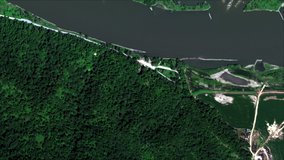
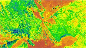
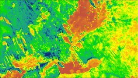
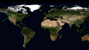
Geostationary Earth Orbit Land Surface Temperature Hourly North and South America 4 km
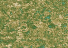
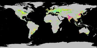
Global Forest Cover Change (GFCC) Forest Cover Change Multi-Year Global 30 m
Global Forest Cover Change (GFCC) Surface Reflectance Estimates Multi-Year Global 30 m
Global Forest Cover Change (GFCC) Tree Cover Multi-Year Global 30 m
Global Forest Cover Change (GFCC) Water Cover 2000 Global 30 m
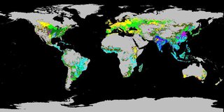
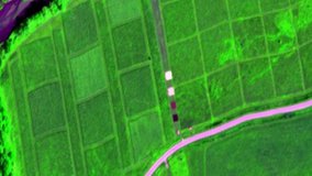
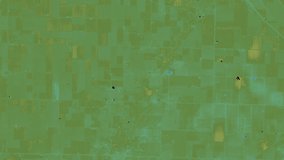
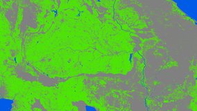
Global Food Security Support Analysis Data (GFSAD) Crop Dominance 2010 Global 1 km
Global Food Security Support Analysis Data (GFSAD) Crop Mask 2010 Global 1 km
Global Food Security-support Analysis Data (GFSAD) Cropland Extent 2015 Africa 30 m
Global Food Security-support Analysis Data (GFSAD) Cropland Extent 2015 Australia, New Zealand, China, Mongolia 30 m
Global Food Security-support Analysis Data (GFSAD) Cropland Extent 2015 Europe, Central Asia, Russia, Middle East 30 m
Global Food Security-support Analysis Data (GFSAD) Cropland Extent 2010 North America 30 m
Global Food Security-support Analysis Data (GFSAD) Cropland Extent 2015 South Asia, Afghanistan, Iran 30 m
Global Food Security-support Analysis Data (GFSAD) Cropland Extent 2015 South America 30 m
Global Food Security-support Analysis Data (GFSAD) Cropland Extent 2015 Southeast and Northeast Asia 30 m
Global Food Security-support Analysis Data (GFSAD) Cropland Extent 2015 Validation 30 m
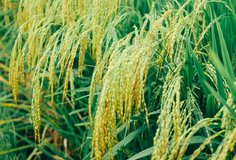
Global Hyperspectral Imaging Spectral-library of Agricultural crops for Central Asia

Global Hyperspectral Imaging Spectral-library of Agricultural crops for Conterminous United States