Search Data Catalog

Status: Operational Clear filters
Showing 61 - 90 of 480 results
Group 2 Band Depth data from the EMITL2BMIN version 1 product over the Gobi Desert in southern Mongolia, Asia on August 11, 2022.
EMIT L2B Estimated Mineral Identification and Band Depth and Uncertainty 60 m
Aggregated mineral spectral abundance of hematite from the EMITL3ASA data product across the globe from August 10, 2022, through July 30, 2023, overlaid on a USGS 2021 imagery basemap from The National Map.
EMIT L3 Aggregated Mineral Spectral Abundance and Uncertainty 0.5 Deg
Example of a Version 2 GEDI L1B sub-orbit granule over North America from June 19, 2019, with NASA’s Blue Marble from July 2004 as a basemap.
GEDI L1B Geolocated Waveform Data Global Footprint Level
Version 2 GEDI L2A Canopy Top Height (rh100) over Redwoods National Park, California, USA from June 19, 2019, with USDA NAIP imagery from 2020 as a basemap.
GEDI L2A Elevation and Height Metrics Data Global Footprint Level
Version 2 GEDI L2B Plant Area Index (PAI) over Redwoods National Park, California, USA from June 19, 2019, with USDA NAIP imagery from 2020 as a basemap.
GEDI L2B Canopy Cover and Vertical Profile Metrics Data Global Footprint Level
Land Surface Temperature (LST) over North America and the Pacific Ocean from the GEOLST4KHR product on May 28, 2002.
Geostationary Earth Orbit Land Surface Temperature Hourly North and South America 4 km
Forest cover change map over part of Brazil.
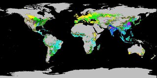
Global Forest Cover Change (GFCC) Forest Cover Change Multi-Year Global 30 m
Surface reflectance band combination 1-4-3 over part of Brazil.
Global Forest Cover Change (GFCC) Surface Reflectance Estimates Multi-Year Global 30 m
Tree Cover data over part of Brazil.
Global Forest Cover Change (GFCC) Tree Cover Multi-Year Global 30 m
Water Cover over part of Brazil.
Global Forest Cover Change (GFCC) Water Cover 2000 Global 30 m
Global view of Crop Dominance
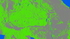
Global Food Security Support Analysis Data (GFSAD) Crop Dominance 2010 Global 1 km
Global view of Crop Mask.
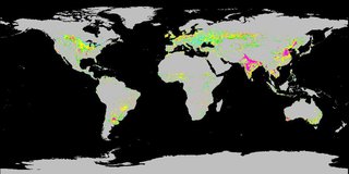
Global Food Security Support Analysis Data (GFSAD) Crop Mask 2010 Global 1 km
Cropland Extent over eastern Africa.
Global Food Security-support Analysis Data (GFSAD) Cropland Extent 2015 Africa 30 m
Cropland Extent over Mongolia.
Global Food Security-support Analysis Data (GFSAD) Cropland Extent 2015 Australia, New Zealand, China, Mongolia 30 m
Cropland Extent over eastern Europe.
Global Food Security-support Analysis Data (GFSAD) Cropland Extent 2015 Europe, Central Asia, Russia, Middle East 30 m
Cropland Extent over the Midwestern, United States.
Global Food Security-support Analysis Data (GFSAD) Cropland Extent 2010 North America 30 m
Cropland Extent over part of India.
Global Food Security-support Analysis Data (GFSAD) Cropland Extent 2015 South Asia, Afghanistan, Iran 30 m
Cropland Extent over part of Brazil.
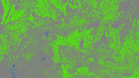
Global Food Security-support Analysis Data (GFSAD) Cropland Extent 2015 South America 30 m
Cropland Extent over part of Thailand.
Global Food Security-support Analysis Data (GFSAD) Cropland Extent 2015 Southeast and Northeast Asia 30 m
Satellite Icon
Global Food Security-support Analysis Data (GFSAD) Cropland Extent 2015 Validation 30 m
Rice is one of the major agricultural crops for Central Asia. Photo Credit: Pixabay
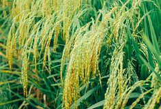
Global Hyperspectral Imaging Spectral-library of Agricultural crops for Central Asia
Wheat is one of the major agricultural crops for the conterminous United States. Photo Credit: Pixabay
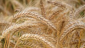
Global Hyperspectral Imaging Spectral-library of Agricultural crops for Conterminous United States
G-LiHT Digital Surface Model image, acquired over Flagstaff, AZ on March 21, 2013.
G-LiHT Digital Surface Model
G-LiHT Digital Terrain Model GeoTIFF HKML Image, acquired over Bowie, Maryland in June 2012.
G-LiHT Digital Terrain Model KML
"Cockpit in the small aircraft" by Trendhim is licensed under CC BY-NC-SA 2.0, accessed from Creative Commons, Feb 4, 2022.
G-LiHT Hyperspectral Ancillary
GLHYVI Hyperspectral Vegetative Indices image, showing NDVI over Bowie, Maryland in June, 2012.
G-LiHT Hyperspectral Vegetative Indices
G-LiHT LiDAR Point Cloud image, acquired over the University of Tennessee, Knoxville, TN, March 25, 2015.
G-LiHT LiDAR Point Cloud
Display
30
results per page