Search Data Catalog

Status: Operational Clear filters
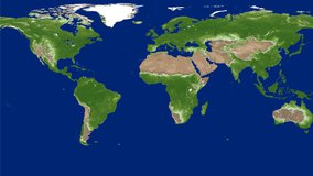
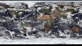
Showing 271 - 360 of 481 results
MYD14A1 image, acquired on January 1, 2003 over the western United States.
MODIS/Aqua Thermal Anomalies/Fire Daily L3 Global 1 km SIN Grid
MYD14A2 image, acquired on January 1, 2003 over the western United States.
MODIS/Aqua Thermal Anomalies/Fire 8-Day L3 Global 1 km SIN Grid
Aqua MODIS evapotranspiration (ET) data from the MYD16A2 product over east Africa from Jan 01 - 08, 2021.
MODIS/Aqua Net Evapotranspiration 8-Day L4 Global 500 m SIN Grid
Aqua MODIS evapotranspiration (ET) data from the MYD16A2GF product over Parana, Brazil from Dec 26 - 31, 2020.
MODIS/Aqua Net Evapotranspiration Gap-Filled 8-Day L4 Global 500 m SIN Grid
Aqua MODIS evapotranspiration (ET) data from the MYD16A3GF product over Thailand and Myanmar, 2020.
MODIS/Aqua Net Evapotranspiration Gap-Filled Yearly L4 Global 500 m SIN Grid
Gross Primary Productivity (GPP) from the MYD17A2H product over central South America on Jan 01 - 08, 2021.
MODIS/Aqua Gross Primary Productivity 8-Day L4 Global 500 m SIN Grid
Aqua MODIS gross primary productivity (GPP) data from the MYD17A2HGF product over Central America from Dec 26 - 31, 2020.
MODIS/Aqua Gross Primary Productivity Gap-Filled 8-Day L4 Global 500 m SIN Grid
Aqua MODIS net primary productivity (NPP) data from the MYD17A3HGF product over Venezuela, 2020.
MODIS/Aqua Net Primary Production Gap-Filled Yearly L4 Global 500 m SIN Grid
Aqua MODIS land surface temperature (LST) data from the MOD21 product over India on Dec 3, 2020.
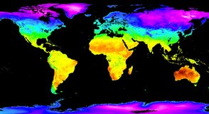
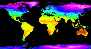
MODIS/Aqua Land Surface Temperature/3-Band Emissivity 5-Min L2 1 km
Aqua MODIS land surface temperature (LST) data from the MYD21A1D product over India on May 9, 2020.
MODIS/Aqua Land Surface Temperature/3-Band Emissivity Daily L3 Global 1 km SIN Grid Day
Aqua MODIS land surface temperature (LST) data from the MYD21A1N product over India on May 07, 2020.
MODIS/Aqua Land Surface Temperature/3-Band Emissivity Daily L3 Global 1 km SIN Grid Night
Aqua MODIS land surface temperature (LST) data from the MYD21A2 product over India on India from Oct 23 - 30, 2020.
MODIS/Aqua Land Surface Temperature/3-Band Emissivity 8-Day L3 Global 1 km SIN Grid
Aqua MODIS land surface temperature (LST) data from the MYD21C1 product Global Aug 15, 2020.
MODIS/Aqua Land Surface Temperature/3-Band Emissivity Daily L3 Global 0.05 Deg CMG
Aqua MODIS land surface temperature (LST) data from the MYD21C2 product Global Jan 17 - 24, 2021.
MODIS/Aqua Land Surface Temperature/3-Band Emissivity 8-Day L3 Global 0.05 Deg CMG
Aqua MODIS land surface temperature (LST) data from the MYD21C3 product Global Oct, 2020.
MODIS/Aqua Land Surface Temperature/3-Band Emissivity Monthly L3 Global 0.05 Deg CMG
"Lake Mead Area - Approaching Las Vegas" by Udo S/ flickr.com / CC By-NCND2.0
MODIS/Aqua Water Reservoir 8-Day L3 Global
"Ladybower" by David Robson/flickr.com/CC BY-NC-ND 2.0
MODIS/Aqua Water Reservoir Monthly L3 Global
NASADEM Slope and Curvature Product over the Grand Canyon, 2000.
NASADEM Slope and Curvature Global 1 arc second
NASADEM SRTM-only Height and Height Precision Product over the Grand Canyon, 2000.
NASADEM SRTM-only Height and Height Precision Product
NASADEM SRTM Image Mosaic Product over the Grand Canyon, 2000.
NASADEM SRTM Image Mosaic Global 1 arc second
NASADEM SRTM Subswath Product over the Grand Canyon, 2000.
NASADEM SRTM Subswath Global 1 arc second
Vegetation disturbance status data from the OPERA Land Surface Disturbance Alert from Harmonized Landsat Sentinel-2 provisional product over Argentina July 28, 2022.
OPERA Land Surface Disturbance Alert from Harmonized Landsat Sentinel-2 provisional product (Version 0)
Vegetation disturbance status data from the OPERA Land Surface Disturbance Alert from Harmonized Landsat Sentinel-2 product over California, Unitied States, on September 18, 2023.
OPERA Land Surface Disturbance Alert from Harmonized Landsat Sentinel-2 product (Version 1)
Vegetation disturbance status data from the OPERA Land Surface Disturbance Annual from Harmonized Landsat Sentinel-2 product over Canada for the year beginning January 2023.
OPERA Land Surface Disturbance Annual from Harmonized Landsat Sentinel-2 product (Version 1)
Elevation over the Democratic Republic of the Congo.
NASA Shuttle Radar Topography Mission Global 1 arc second
Satellite Icon
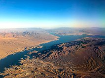
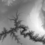
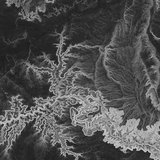
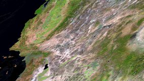
NASA Shuttle Radar Topography Mission Global 1 arc second number
Elevation over the Democratic Republic of the Congo.
NASA Shuttle Radar Topography Mission Global 3 arc second
Elevation over eastern Africa.
NASA Shuttle Radar Topography Mission Global 30 arc second
Satellite Icon
NASA Shuttle Radar Topography Mission Global 3 arc second number
Elevation over the Democratic Republic of the Congo.
NASA Shuttle Radar Topography Mission Global 3 arc second sub-sampled
Radar Brightness Values over the Democratic Republic of the Congo.
NASA Shuttle Radar Topography Mission Combined Image Data Set
Radar Sub-swath Brightness Values over the Democratic Republic of the Congo.
NASA Shuttle Radar Topography Mission Swath Image Data Set
Water Body Attributes over the Democratic Republic of the Congo.
NASA Shuttle Radar Topography Mission Water Body Data Shapefiles and Raster Files
Global view of Percent Tree Cover.
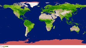
MEaSUREs Vegetation Continuous Fields (VCF) Yearly Global 0.05 Deg
Global view of the Daily NDVI.
Vegetation Index and Phenology (VIP) Vegetation Indices Daily Global 0.05 Deg CMG
Global view of the 7 Day NDVI.
Vegetation Index and Phenology (VIP) Vegetation Indices 7 Days Global 0.05 Deg CMG
Global view of the 15 Day NDVI.
Vegetation Index and Phenology (VIP) Vegetation Indices 15 Days Global 0.05 Deg CMG
Global view of the Monthly NDVI.
Vegetation Index and Phenology (VIP) Vegetation Indices Monthly Global 0.05 Deg CMG
Global view of the Maximum Vegetation Index Season 1.
Vegetation Index and Phenology (VIP) Phenology EVI2 Yearly Global 0.05 Deg CMG
Global view of the Maximum Vegetation Index Season 1.
Vegetation Index and Phenology (VIP) Phenology NDVI Yearly Global 0.05 Deg CMG
The VJ103MODLL geolocation product over the Western US on August 23, 2023.
VIIRS/JPSS1 Moderate Resolution Terrain Corrected Geolocation 6-Min L1 Swath 750 m Light
The VJ109A1 surface reflectance band M5-M4-M3 data over the Mojave Desert, United States, September 6 to September 13, 2018.
VIIRS/JPSS1 Surface Reflectance 8-Day L3 Global 1 km SIN Grid
A global image of the VJ109CMG surface reflectance band M5-M4-M3 data from September 17, 2018.
VIIRS/JPSS1 Surface Reflectance Daily L3 Global 0.05 Deg CMG
The VJ109GA surface reflectance band M5-M4-M3 data over the Mojave Desert, United States on March 8, 2022.
VIIRS/JPSS1 Surface Reflectance Daily L2G Global 1 km and 500 m SIN Grid
The VJ109H1 surface reflectance band I3-I2-I1 data over the Mojave Desert, United States, September 6 to September 13, 2018.
VIIRS/JPSS1 Surface Reflectance 8-Day L3 Global 500 m SIN Grid
NDVI from the VJ113A1 product over Brazil United States during July, 2023.
VIIRS/JPSS1 Vegetation Indices 16-Day L3 Global 500 m SIN Grid
NDVI from the VNP13A2 product over Brazil United States during July, 2023.
VIIRS/JPSS1 Vegetation Indices 16-Day L3 Global 1 km SIN Grid
NDVI from the VNP13A3 product over Brazil United States during July, 2023.
VIIRS/JPSS1 Vegetation Indices Monthly L3 Global 1 km SIN Grid
Global NDVI image from VJ113C1 product during July 2023.
VIIRS/JPSS1 Vegetation Indices 16-Day L3 Global 0.05 Deg CMG
Global NDVI image from VJ113C2 product during June 2023.
VIIRS/JPSS1 Vegetation Indices Monthly L3 Global 0.05 Deg CMG
VNP14 thermal anomalies/fire product fire mask over the Western US on July 23, 2023.
VIIRS/JPSS1 Thermal Anomalies/Fire 6-Min L2 Swath 750 m
VJ114A1 thermal anomalies/fire product over the Western US on August 22, 2023..
VIIRS/JPSS1 Thermal Anomalies and Fire Daily L3 Global 1 km SIN Grid
Land Surface Temperature from the VJ121 product over Chad, Africa during April 7, 2019.
VIIRS/JPSS1 Land Surface Temperature and Emissivity 6-Min L2 Swath 750 m
Land Surface Temperature from the VJ121A1D product over the western United States during June 18, 2018.
VIIRS/JPSS1 Land Surface Temperature/Emissivity Daily L3 Global 1 km SIN Grid Day
Nighttime Land Surface Temperature from the VJ121A1N product over the western United States during June 18, 2018.
VIIRS/JPSS1 Land Surface Temperature/Emissivity Daily L3 Global 1 km SIN Grid Night
Land Surface Temperature from the VJ121A2 product over the western United States during April 15 - April 23, 2019.
VIIRS/JPSS1 Land Surface Temperature/Emissivity 8-Day L3 Global 1 km SIN Grid
A global Land Surface Temperature image from the VJ121C1 product during May 12, 2020.
VIIRS/JPSS1 Land Surface Temperature/Emissivity Daily L3 Global 0.05 Deg CMG
A global Land Surface Temperature image from the VNP21C2 product during May 10, 2020.
VIIRS/JPSS1 Land Surface Temperature/Emissivity 8-Day L3 Global 0.05 Deg CMG
A global Land Surface Temperature image from the VJ121C2 product during May 9, 2020.
VIIRS/JPSS1 Land Surface Temperature/Emissivity Monthly L3 Global 0.05 Deg CMG
Lake Mead in Nevada on August 28, 2015, is one of the water reservoirs included in the VJ128C2 data product. Photo Credit: “Lake Mead near Hoover Dam” by Mircea Goia /flickr.com/CC BY-NC-SA 2.0
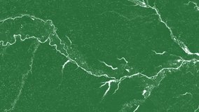
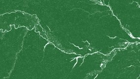
VIIRS/JPSS1 Water Reservoir Area 8-day L3 Global
Lake Hawea in Otago Region, New Zealand on June 1, 2016, is one of the water reservoirs included in the VJ128C3 data product. Photo Credit: “Lake Hawea, Otago” by Shellie /flickr.com/CC BY-NC-ND 2.0
VIIRS/JPSS1 Water Reservoir Monthly L3 Global
The VNP03MODLL geolocation product over the Western US.
VIIRS/NPP Moderate Resolution Terrain Corrected Geolocation 6-Min L1 Swath 750 m Light
The VNP03MODLL geolocation product over the Western US on August 23, 2023.
VIIRS/NPP Moderate Resolution Terrain Corrected Geolocation 6-Min L1 Swath 750 m Light
The VNP09A1 surface reflectance band M5-M4-M3 data over the Mojave Desert, United States, September 6 to September 13, 2018.
VIIRS/NPP Surface Reflectance 8-Day L3 Global 1 km SIN Grid
Global image of the VNP09 CMG surface reflectance product.
VIIRS/NPP Surface Reflectance Daily L3 Global 0.05 Deg CMG
A global image of the VJ109CMG surface reflectance band M5-M4-M3 data from September 17, 2018.
VIIRS/NPP Surface Reflectance Daily L3 Global 0.05 Deg CMG
VNP09GA surface reflectance product over the Western US.
VIIRS/NPP Surface Reflectance Daily L2G Global 1 km and 500 m SIN Grid
The VNP09GA surface reflectance band M5-M4-M3 data over the Mojave Desert, United States on March 8, 2022.
VIIRS/NPP Surface Reflectance Daily L2G Global 1 km and 500 m SIN Grid
The VNP09H1 surface reflectance band I3-I2-I1 data over the Mojave Desert, United States, September 6 to September 13, 2018.
VIIRS/NPP Surface Reflectance 8-Day L3 Global 500 m SIN Grid
NDVI from the VNP13A1 product over Brazil United States during July, 2023.
VIIRS/NPP Vegetation Indices 16-Day L3 Global 500 m SIN Grid
NDVI from the VNP13A2 product over Brazil United States during July, 2023.
VIIRS/NPP Vegetation Indices 16-Day L3 Global 1 km SIN Grid
NDVI from the VNP13A3 product over Brazil United States during July, 2023.
VIIRS/NPP Vegetation Indices Monthly L3 Global 1 km SIN Grid
Global image of EVI compiled from the VNP13C1 product.
VIIRS/NPP Vegetation Indices 16-Day L3 Global 0.05 Deg CMG
Global NDVI image from VNP13C1 product during July 2023.
VIIRS/NPP Vegetation Indices 16-Day L3 Global 0.05 Deg CMG
Global image of EVI from the VNP13C2 product.
VIIRS/NPP Vegetation Indices Monthly L3 Global 0.05 Deg CMG
Global NDVI image from VNP13C2 product during June 2023.
VIIRS/NPP Vegetation Indices Monthly L3 Global 0.05 Deg CMG
VNP14 thermal anomalies product over the Western US.
VIIRS/NPP Thermal Anomalies/Fire 6-Min L2 Swath 750 m
VNP14 thermal anomalies/fire product fire mask over the Western US on July 23, 2023.
VIIRS/NPP Thermal Anomalies/Fire 6-Min L2 Swath 750 m
VNP14A1 thermal anomalies/fire product over the Western US on July 23, 2023.
VIIRS/NPP Thermal Anomalies and Fire Daily L3 Global 1 km SIN Grid
Display
90
results per page