The LP DAAC is pleased to announce the release of a new V004 data set:
MODIS/Terra Land Cover Types Yearly L3 Global 0.05Deg CMG -MOD12C1
- V003 Oct 15 2000 (2000289) - Oct 15 2001 (2001288)Validated Stage 1
- V004 2001 -Validated Stage 1
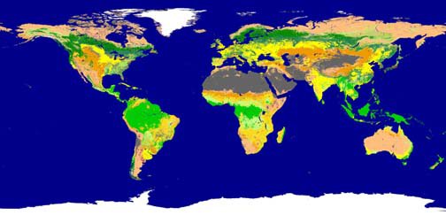
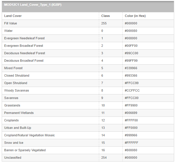
2001 image of MOD12C1 IGBP Land Cover classification scheme.
Legend follows in table "MOD12C1 Land_Cover_Type_1 (IGBP)" below.
Data Set Characteristics:
Image Dimensions = 2D LC Type (row/column)
Image Dimensions = 3D LC Percent (row/column/# of LC Classes)
Area = Global
Size = 3600 x 7200 rows/columns
Average File Size = 1200 MB
Resolution = 0.05 degree (~5600m)
Projection = GCTP_GEO
Data Type = 8-Bit Unsigned Integer
Data Format = HDF-EOS
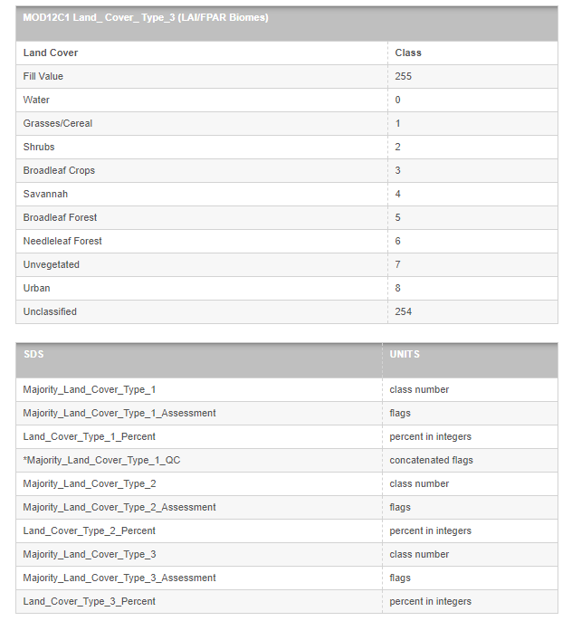
Science Data Sets (SDS) = 10
Product Description:
The MODerate-resolution Imaging Spectroradiometer (MODIS) Land Cover Classification products contain multiple classification schemes describing land cover properties. The primary land cover scheme identifies 17 classes of land cover defined by the International Geosphere-Biosphere Programme (IGBP) which include 11 natural vegetation classes, 3 developed land classes, one of which is a mosaic with natural vegetation, permanent snow or ice, barren or sparsely vegetated, and water. The MOD12 classification schemes are multitemporal classes describing land cover properties as observed during the year (12 months of input data). Successive production at quarterly intervals of this "annual" product creates new land cover maps with increasing accuracies as both classification techniques and the training site database mature.
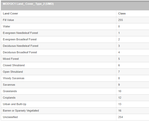
The MODIS/Terra Land Cover Types Yearly L3 Global 0.05Deg CMG product, MOD12C1, includes IGBP classification and two additional classification schemes at a 0.05 degree (~5600m) spatial resolution. One is specific to MODIS Land Product development at the University of Maryland and is a version of the IGBP modified to exclude wetlands, vegetation mosaic, and snow information. The third Land Cover classification scheme is input to the MODIS LAI/fPAR product, MOD15A2, and emphasizes vegetation classes.
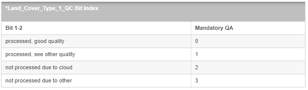
The images displayed represent a global image of the IGBP Land Cover Science Data Set (SDS), with a subset of the Land Cover Percentage SDS over the Great Lakes region of the United States. Land Cover Percentage is a multidimensional SDS that displays what percentage of each pixel is covered by a given Land Cover type (i.e., there is a data layer identifying how much of a pixel contains water, another data layer identifying how much of a pixel contains grasslands, etc.). MOD12C1 also contains Land Cover Quality Control which marks each pixel with bit-encoded, high-level QC information related to production input (*see below). The Land Cover Assessment SDS imparts a confidence value to the classification each pixel.
NOTE: This product is "Validated Stage 1." Product accuracy has been estimated using a small number of independent measurements obtained from selected locations and time periods and ground-truth/field program effort.