Search Data Catalog

Status: Operational Clear filters
Showing 241 - 255 of 484 results
Terra MODIS land surface temperature (LST) data from the MOD21A1D product over India on May 3, 2020.
MODIS/Terra Land Surface Temperature/3-Band Emissivity Daily L3 Global 1 km SIN Grid Day
Terra MODIS land surface temperature (LST) data from the MOD21A1N product over India on May 08, 2020.
MODIS/Terra Land Surface Temperature/3-Band Emissivity Daily L3 Global 1 km SIN Grid Night
Terra MODIS land surface temperature (LST) data from the MOD21A2 product over India on January 1 - 8, 2020.
MODIS/Terra Land Surface Temperature/3-Band Emissivity 8-Day L3 Global 1 km SIN Grid
Terra MODIS land surface temperature (LST) data from the MOD21C1 product Global Aug 31, 2020.
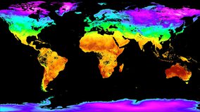
MODIS/Terra Land Surface Temperature/3-Band Emissivity Daily L3 Global 0.05 Deg CMG
Terra MODIS land surface temperature (LST) data from the MOD21C2 product Global Jan 01 - 08, 2021.
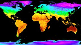
MODIS/Terra Land Surface Temperature/3-Band Emissivity 8-Day L3 Global 0.05 Deg CMG
Terra MODIS land surface temperature (LST) data from the MOD21C3 product Global Dec, 2020.
MODIS/Terra Land Surface Temperature/3-Band Emissivity Monthly L3 Global 0.05 Deg CMG
"Blåsjø reservoir" by Statekraft / flickr.com / CC By-NCND2.0
MODIS/Terra Water Reservoir 8-Day L3 Global
"Cougar Reservoir" by Don Hankins/flickr.com/CC BY 2.0
MODIS/Terra Water Reservoir Monthly L3 Global
Terra MODIS percent tree cover (PTC) data from MOD44B V6.1 over the Orinoco River in Venezuela, South America on March 5, 2008.
MODIS/Terra Vegetation Continuous Fields Yearly L3 Global 250 m SIN Grid
Land/Water Mask from the MOD44W product over the Great Lakes, USA on January 01, 2015.
MODIS/Terra Land Water Mask Derived from MODIS and SRTM L3 Yearly Global 250 m SIN Grid
Terra MODIS Annual Water Mask data from MOD44W v6.1 over Lake Superior and surrounding areas in Minnesota and Wisconsin (United States), North America for 2022.
MODIS/Terra Land Water Mask Derived from MODIS and SRTM L3 Yearly Global 250 m SIN Grid
MSLSP 30 m EVIMax image over the Mississippi River flood plain in northeastern Louisiana, 2019.
MuSLI Multi-Source Land Surface Phenology Yearly North America 30 m
Aqua MODIS surface reflectance band 1-4-3 data from the MYD09A1 product over the western United States, Jan 01 - Jan 08, 2021.
MODIS/Aqua Surface Reflectance 8-Day L3 Global 500 m SIN Grid
A global image of the MYD09CMG.061 global product from January 16th, 2021.
MODIS/Aqua Surface Reflectance Daily L3 Global 0.05 Deg CMG
Aqua MODIS surface reflectance band 1-4-3 data from the MYD09GA product over the western United States, December 4th, 2020.
MODIS/Aqua Surface Reflectance Daily L2G Global 1 km and 500 m SIN Grid
Display
15
results per page