The MODIS Terra Vegetation Index (MOD13C1) product was used to create a global time series animation depicting spatial and temporal variation in vegetation cover. These gridded vegetation index maps are derived from a 0.05 degree (5,600-meter) geographic Climate Modeling Grid (CMG), which produce cloud-free global coverage at 16-day and monthly intervals for seasonal and interannual monitoring of Earth’s vegetation. This time series animation displays a frame every 16 days beginning on February 2, 2000, and ending on December 19, 2013. During winter months, data at the poles are not collected; therefore, no data were available and the poles appear to be “cut-off.” Watch as the global vegetation conditions change through seasons and over time.
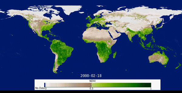
This time series animation features 320 images from the 16-day MODIS Terra Vegetation Index (MOD13C1) product starting on February 2, 2000, through December 19, 2013.
This time series animation features 320 images from the 16-day MODIS Terra Vegetation Index (MOD13C1) product starting on February 2, 2000, through December 19, 2013.