Showing 61 - 75 of 678 results
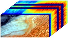
ECOSTRESS Tiled Land Surface Temperature and Emissivity Instantaneous L2 Global 70 m
ECOSTRESS Tiled Ancillary NDVI and Albedo L2 Global 70 m
ECOSTRESS Swath Land Surface Temperature and Emissivity Instantaneous L2 Global 70 m
ECOSTRESS Gridded Evapotranspiration Instantaneous and Daytime L3 Global 70 m
ECOSTRESS Gridded Downscaled Meteorology Instantaneous L3 Global 70 m
ECOSTRESS Gridded Surface Energy Balance Instantaneous L3 Global 70 m
EMIT L1B At-Sensor Calibrated Radiance and Geolocation Data 60 m
EMIT L2A Estimated Surface Reflectance and Uncertainty and Masks 60 m
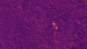
EMIT L2B Methane Enhancement Data 60 m
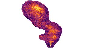
EMIT L2B Estimated Methane Plume Complexes 60 m
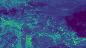
EMIT L2B Estimated Mineral Identification and Band Depth and Uncertainty 60 m
EMIT L3 Aggregated Mineral Spectral Abundance and Uncertainty 0.5 Deg
GEDI L1B Geolocated Waveform Data Global Footprint Level
GEDI L1B Geolocated Waveform Data Global Footprint Level