Home
About
About LP DAAC
News Archive
Data
Get Started with Data
Search Data Catalog
Data Citations and Policies
View All Data
Tools
AppEEARS
Data Pool
Data Prep Scripts
NASA Earthdata Search
USGS EarthExplorer
View All Tools
Resources
Data in Action
E-Learning
Podcasts
Outreach Materials
Publications Table
FAQs
View All Resources
Contact
Contact Information
Submit Data
General Site Search
Home
Data
Search Data Catalog
Search Data Catalog
Cloud Access
Yes (272)
Temporal Range
Start
End
Please enter at least one date
Collection
ASTER GED (3)
Airborne Hyperspectral (4)
Aqua MODIS (39)
Combined MODIS (98)
ECOSTRESS (33)
EMIT (6)
G-LiHT (13)
GEDI (3)
GHISA (2)
HLS (2)
Headwall (1)
LGRIP (1)
LPJ-PROSAIL (2)
MEaSUREs GFCC (4)
MEaSUREs GFSAD (10)
MEaSUREs GLanCE (1)
MEaSUREs LSTE (9)
MEaSUREs NASADEM (5)
MEaSUREs SRTM (9)
MEaSUREs VCF (1)
MEaSUREs VIP (6)
MEaSUREs WELD and GWELD (4)
MuSLI (1)
NOAA-20 VIIRS (23)
SNWG OPERA Disturbance (3)
Suomi NPP VIIRS (148)
Terra ASTER (18)
Terra MODIS (42)
Version
0 (1)
1 (191)
1.1 (1)
2 (75)
2.1 (2)
3 (32)
3.1 (3)
4 (6)
4.1 (1)
6 (2)
6.1 (173)
6.2 (4)
Keyword
Aerosol Optical Depth (2)
Albedo (129)
At-Sensor Radiance (12)
Bidirectional Reflectance Distribution Function (BRDF) (153)
Burned Area (2)
Canopy Characteristics (2)
Canopy Height (6)
Canopy Profile (2)
Cloud (3)
Cropland (13)
Downward Shortwave Radiation (DSR) (2)
Elevation (35)
Emissivity (64)
Evaporative Stress Index (ESI) (3)
Evapotranspiration (ET) (14)
Fraction of Photosynthetically Active Radiation (FPAR) (7)
Greenhouse Gases (GHG) (2)
Gross Primary Productivity (GPP) (4)
Land Cover (24)
Land Surface Temperature (LST) (60)
Leaf Area Index (LAI) (7)
Lidar (15)
Methane (CH4) (2)
Near-surface Air Temperature (2)
Net Primary Productivity (NPP) (2)
Phenology (10)
Photosynthetically Active Radiation (PAR) (4)
Quality (26)
Relative Humidity (2)
Soil Moisture (SM) (2)
Spectroscopy (8)
Surface Energy Balance (SEB) (2)
Surface Radiance (6)
Surface Reflectance (64)
Thermal Anomalies and Fire (14)
Unprocessed (2)
Vegetation Continuous Fields (VCF) (2)
Vegetation Indices (VI) (50)
Water (13)
Water Use Efficiency (WUE) (1)
Waveform (1)
Spatial Resolution (m)
0.001 (1)
0.3 (2)
1 (14)
15 (14)
25 (3)
30 (50)
60 (5)
70 (31)
90 (14)
100 (1)
250 (9)
375 (2)
500 (49)
750 (9)
1000 (227)
4000 (1)
5600 (71)
50000 (3)
Temporal Resolution
< Daily (24)
Daily (231)
Monthly (45)
Multi-Day (73)
Multi-Year (16)
Other (32)
Varies (48)
Weekly (1)
Yearly (20)
Spatial Extent
Africa (457)
Antarctica (392)
Asia (461)
Australia (458)
Europe (457)
North America (480)
South America (456)
Tool
AppEEARS (122)
DAAC2Disk Utility (193)
Data Pool (401)
Data Prep Scripts (21)
LDOPE (161)
NASA Earthdata Search (484)
OPeNDAP (193)
USGS EarthExplorer (238)
Web Services (3)
Status
Operational (491)
Status: Operational
Clear filters
Showing
61 - 75 of 491
results
Cards
List
ECO_L3T_JET v002
ECOSTRESS Tiled Evapotranspiration Instantaneous and Daytime L3 Global 70 m
Ecostress
Evapotranspiration (Et)
ECO_L3T_MET v002
ECOSTRESS Tiled Downscaled Meteorology Instantaneous L3 Global 70 m
Ecostress
Near-Surface Air Temperature
Relative Humidity
ECO_L3T_SEB v002
ECOSTRESS Tiled Surface Energy Balance Instantaneous L3 Global 70 m
Ecostress
Surface Energy Balance (Seb)
ECO_L3T_SM v002
ECOSTRESS Tiled Downscaled Soil Moisture Instantaneous L3 Global 70 m
Ecostress
Soil Moisture (Sm)
EMITL1BRAD v001
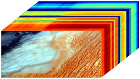
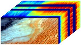
EMIT L1B At-Sensor Calibrated Radiance and Geolocation Data 60 m
Emit
At-Sensor Radiance
Spectroscopy
EMITL2ARFL v001
EMIT L2A Estimated Surface Reflectance and Uncertainty and Masks 60 m
Emit
Spectroscopy
Surface Reflectance
EMITL2BCH4ENH v001
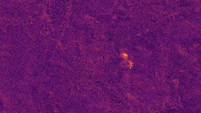
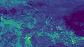
EMIT L2B Methane Enhancement Data 60 m
Emit
Greenhouse Gases (Ghg)
Methane (Ch4)
Spectroscopy
EMITL2BCH4PLM v001
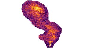
EMIT L2B Estimated Methane Plume Complexes 60 m
Emit
Greenhouse Gases (Ghg)
Methane (Ch4)
Spectroscopy
EMITL2BMIN v001
EMIT L2B Estimated Mineral Identification and Band Depth and Uncertainty 60 m
Emit
Spectroscopy
EMITL3ASA v001
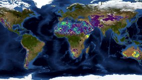
EMIT L3 Aggregated Mineral Spectral Abundance and Uncertainty 0.5 Deg
Emit
Spectroscopy
GEDI01_B v002
GEDI L1B Geolocated Waveform Data Global Footprint Level
Gedi
Elevation
Lidar
Waveform
GEDI02_A v002
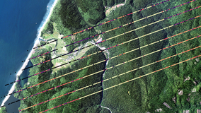
GEDI L2A Elevation and Height Metrics Data Global Footprint Level
Gedi
Canopy Characteristics
Canopy Height
Canopy Profile
Elevation
Lidar
GEDI02_B v002
GEDI L2B Canopy Cover and Vertical Profile Metrics Data Global Footprint Level
Gedi
Canopy Characteristics
Canopy Height
Canopy Profile
Elevation
Lidar
GEOLST4KHR v002
Geostationary Earth Orbit Land Surface Temperature Hourly North and South America 4 km
Measures Lste
Land Surface Temperature (Lst)
GFCC30FCC v001
Global Forest Cover Change (GFCC) Forest Cover Change Multi-Year Global 30 m
Measures Gfcc
Land Cover
Display
15
15
30
60
90
results per page
1
2
3
4
5
6
7
8
…
33